
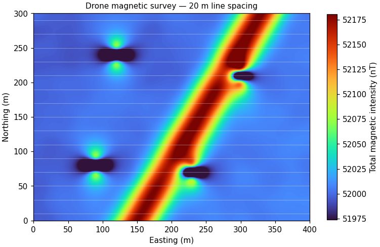
Right-of-way assessment
A drone flies magnetics and LiDAR over 20 km of right-of-way in two days. The magnetic data trace the steel line and two unmapped crossings, LiDAR flags erosion at a creek crossing, and GPR and EM confirm depth of cover where the drone data show the line coming shallow.