
Claim-block drone magnetics
A junior explorer has 20 km² of claims in steep terrain. A drone magnetic survey at 25 m line spacing maps a magnetic low along a fault. IP on three lines ranks the targets for the first drill program.
Targeting metallic and industrial mineral deposits.
Geophysics puts drill holes where they are most likely to hit. We design staged programs: airborne or drone surveys to map structure and alteration across a claim block, then ground IP, EM or gravity to rank targets before drilling.
Drone-enabled
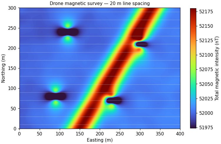
A junior explorer has 20 km² of claims in steep terrain. A drone magnetic survey at 25 m line spacing maps a magnetic low along a fault. IP on three lines ranks the targets for the first drill program.
Send a location and the question you need answered. We'll recommend a method and a budget range.
Send a location and the question you need answered. We'll recommend a method and a budget range.