
Rural well siting in fractured granite
A landowner with two dry wells needs a third location. ERT profiles across the property locate a low-resistivity fracture zone, and the new well is drilled at the intersection of two profiles.
Mapping aquifers from a single well site to an entire basin.
Groundwater is the most common reason clients call a geophysicist in arid regions. Geophysics shows where water-bearing sand and gravel lie, how thick they are, where they are cut by faults or clay, and where fresh water gives way to brackish water. That lets you place wells where they will produce and avoid dry holes.
Drone-enabled
A landowner with two dry wells needs a third location. ERT profiles across the property locate a low-resistivity fracture zone, and the new well is drilled at the intersection of two profiles.
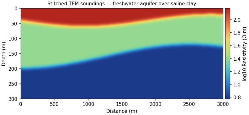
A water district needs aquifer thickness across a 200 km² valley. Airborne or stitched ground TEM maps the aquifer base, and gravity constrains basin depth where the TEM signal runs out.
Send a location and the question you need answered. We'll recommend a method and a budget range.
Send a location and the question you need answered. We'll recommend a method and a budget range.