
Highway cut rippability
A DOT needs to know how much rock must be blasted. Refraction lines along the alignment map where velocities exceed ripping thresholds, cutting the uncertainty in the excavation bid.
Subsurface conditions for infrastructure and construction.
Borings tell you what is at a point. Geophysics tells you what is between the borings. We map bedrock depth, weak zones, voids, stiffness and rippability so engineers can place borings wisely, reduce change orders and design foundations with confidence.
Drone-enabled
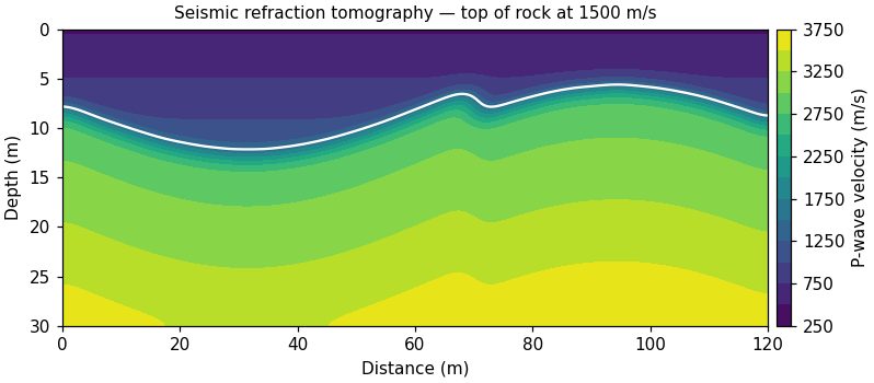
A DOT needs to know how much rock must be blasted. Refraction lines along the alignment map where velocities exceed ripping thresholds, cutting the uncertainty in the excavation bid.
A solar developer needs soil resistivity for grounding design. Wenner soundings and ERT across the site give layered resistivity models for the electrical engineer.
Send a location and the question you need answered. We'll recommend a method and a budget range.
Send a location and the question you need answered. We'll recommend a method and a budget range.